In Nigeria today, as more construction projects push into coastal, riverside, and swampy areas, one question keeps popping up from engineers, real estate developers, and contractors alike:
“Do I need a bathymetric survey before I start work?”
It’s a fair question. After all, hiring a survey team with specialized equipment like echo sounders and GNSS receivers adds to the project cost. In some cases, developers are tempted to “just get started” with visible topography alone, trusting local knowledge, tide marks, or old site records.
But here’s the uncomfortable truth: many water-based projects in Nigeria fail or get delayed because they skipped this one critical step.
Let’s break it down.
Why Is Bathymetric Survey So Important?
Bathymetric surveys measure the depth and shape of the waterbed. That means before you start piling, dredging, or constructing a foundation near or on water, you already know what you’re standing on or what’s underneath you.
Without it, you’re essentially guessing.
- Is the riverbed flat or sharply sloped?
- Is there soft mud that can’t carry weight?
- Are there hidden objects like submerged logs or wrecks?
- Has the bed shifted from erosion since the last record?
- What’s the actual depth during high tide and low tide?
A bathymetric survey answers all of these questions with data, not assumptions.
“What If I’m Not Building a Bridge or a Port?”
Good question. Bathymetric surveys are not just for mega projects.
If you’re:
- Building a jetty for a hotel or resort
- Reclaiming land along the Lagos Lagoon
- Developing a waterfront estate
- Planning shoreline protection for erosion control
- Or even doing dredging for real estate development
Then a bathymetric survey can make or break your project.
Many Lagos developers working around Lekki, Epe, and Badagry are now facing erosion threats and flooding because their site planning ignored underwater terrain data.
“Can’t I Just Use Google Maps or Old River Charts?”
Short answer: No.
Google Maps and satellite imagery do not show underwater depths or bed conditions. And many river charts in Nigeria are outdated, not designed for engineering use, or have low resolution.
Only a professionally done bathymetric survey using echo sounders and high-precision GNSS can give you accurate and engineering-grade data.
The Misconception: “Only Needed for Sand Filling”
In Nigeria, there’s a common but dangerous belief that bathymetric surveys are only for companies that want to sandfill land from water. While that’s a major use case, the truth is this: if you’re planning any development near water, whether it’s a waterfront estate, jetty, bridge, terminal, dredging operation, or even flood control, you need a bathymetric survey.
Why? Because what’s beneath the water matters just as much as what’s on land. If you don’t understand the shape, depth, and condition of the seabed or riverbed, you’re risking structural failure, unexpected construction delays, and massive cost overruns.
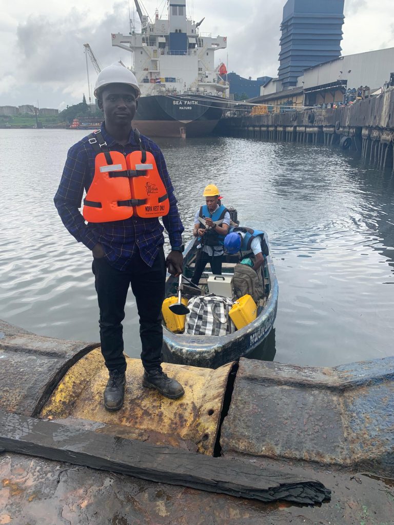
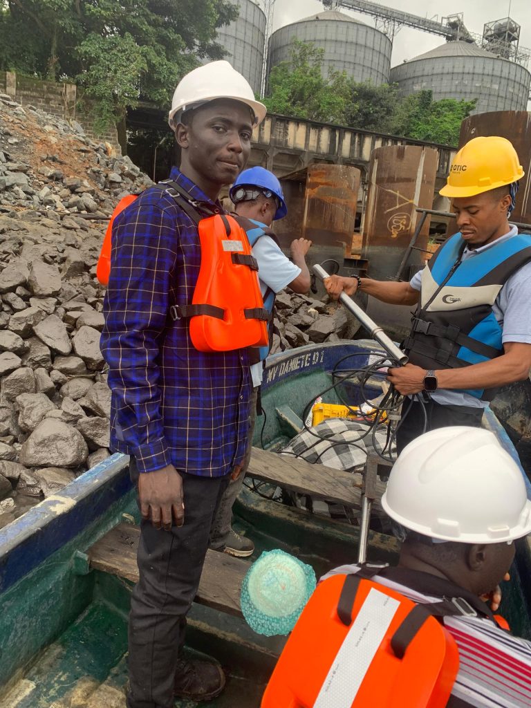
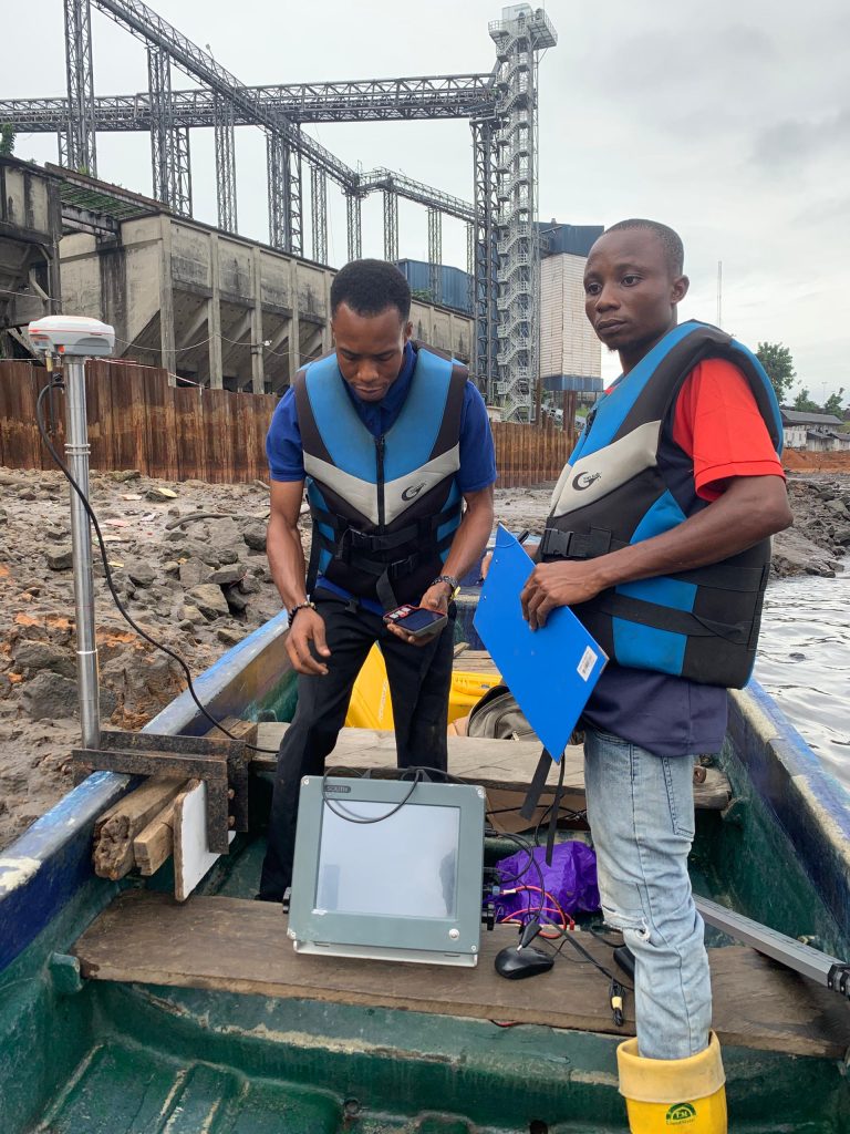
Real Projects We’ve Done: How Bathymetry Prevented Costly Mistakes
At OTIC Surveys, we have seen how bathymetric data protects our clients from serious construction errors. Let’s walk through some of our real-world experiences:
Ikate Dredging Site, Lagos:
Here, we carried out a bathymetric survey to help the client determine how much material needed to be dredged. With an accurate seabed profile, they were able to plan equipment, manpower, and budget properly, saving both time and money.
Port Harcourt Jetty & Seabed Scan:
In Port Harcourt, we worked for a returning client who needed a detailed underwater map not only to understand depth but also to scan the seabed for any obstructions. During this process, our team not only mapped the depth variations, checked for debris, and captured the underwater terrain but we also discovered several hidden objects, including a sunken canoe trapped between the pile legs of an existing finger jetty. These kinds of submerged hazards could have damaged equipment or compromised new foundations, but our early detection helped avoid disaster. Now, armed with accurate data, their engineers designed confidently, saved cost on dredging, and kept the project timeline on track.
So, Do You Need a Bathymetric Survey?
If your project touches or comes close to water, the answer is yes.
So, you need a bathymetric survey if you are:
- A Developer planning an estate near the lagoon, river, or coastline
- A Construction firm building jetties, bridges, terminals, or ports
- Government agencies working on flood control or shoreline protection
- Marine engineers need to dredge or assess the seabed integrity
- Even real estate investors check the stability of waterfront plots
Skipping a bathymetric survey is like designing a building without knowing what soil it will sit on.
Bathymetric survey is not a luxury. It’s part of responsible planning, and it’s far more affordable than fixing a major problem down the line.
Let me reiterate, if you’re working anywhere near water, the hidden conditions beneath the surface, soft mud, uneven terrain, debris, or buried objects can make or break your project. Bathymetric surveys uncover those risks before they become expensive problems.
What will happen if you don’t conduct a bathymetric survey?
As land becomes scarce in urban areas like Lagos, more people are building closer to water, sometimes without proper geotechnical and bathymetric information. This is risky. Poor planning can lead to:
- Failed piling work due to soft or unstable seabed
- Structural collapse from underwater erosion
- Damage to marine equipment from unknown debris
- Regulatory violations or shutdowns during inspection
A proper bathymetric survey solves these problems before they even begin.
How to Get Started
Bathymetric surveys don’t have to be complicated. At OTIC Surveys Ltd, we simplify the process. We assess your site, deploy our team equipped with specialized GNSS and echo-sounding equipment, and deliver clean, usable data, ranging from depth charts to 3D models, within a few days.
So, before you break ground or drive the first pile, ask yourself: Do I know what’s beneath the water I’m building on?
If not, let’s help you find out accurately, affordably, and professionally.