Some Projects
Explore our successful projects across various industries
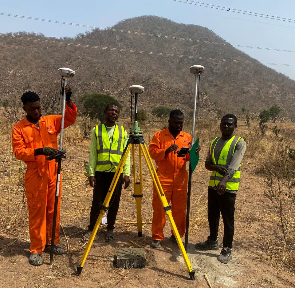
Route Survey for Road Construction, Taraba State.
Our team completed a comprehensive route survey along the Taraba corridor to support planned road construction works. The survey captured high-density spatial data along the proposed alignment, providing accurate information on terrain, existing features, and right-of-way conditions to support design, planning, and construction decision-making.
Route Survey - High-density spatial data
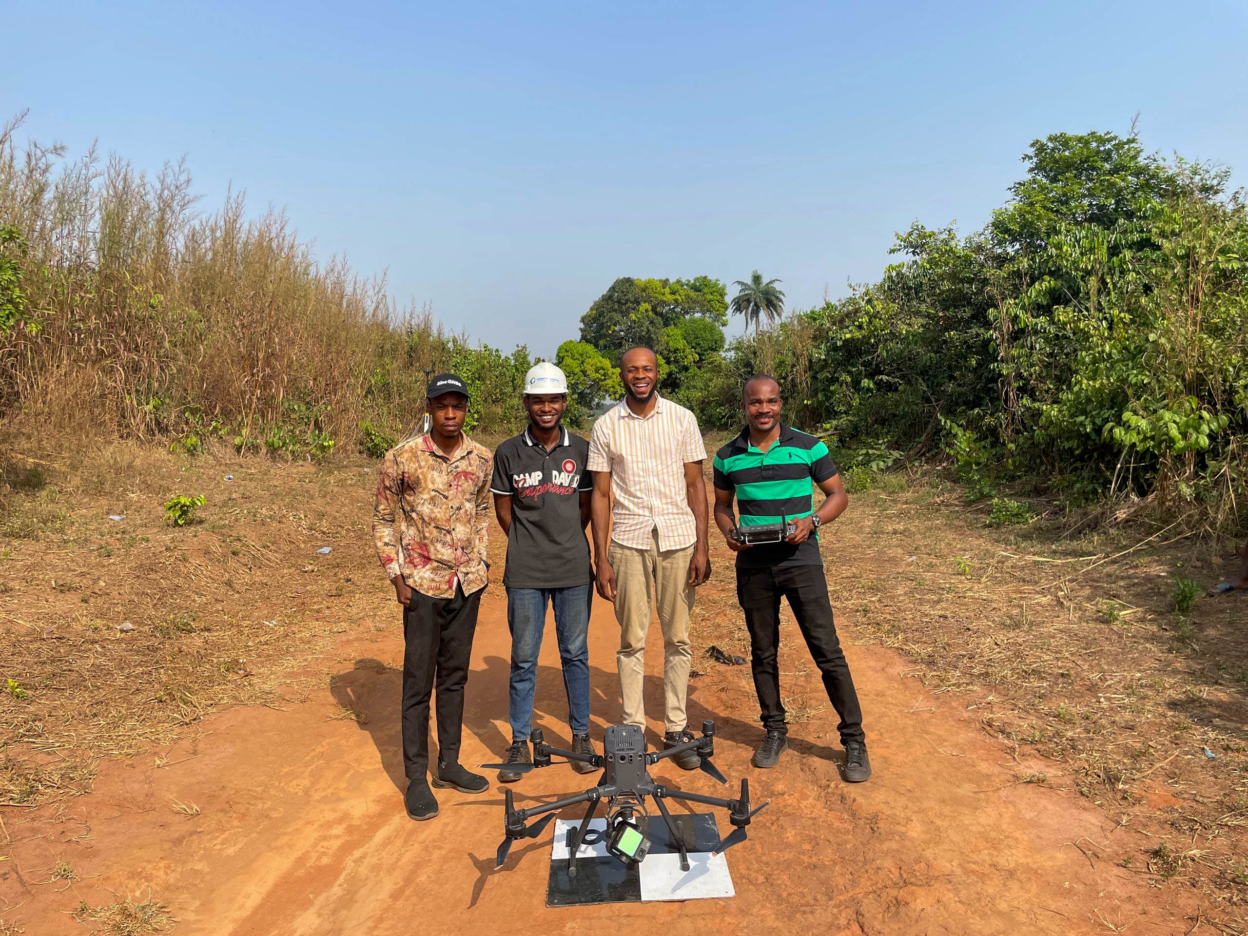
Topographic Survey of the Proposed Abia State Airport
Our team completed a comprehensive topographic survey of the proposed Abia State Airport using the DGI M350 UAV and L2 LiDAR technology. Millions of data points were captured to generate accurate terrain models, supporting airport design, earthworks planning, and informed construction decision-making.
Topographic Survey - High-density LiDAR data
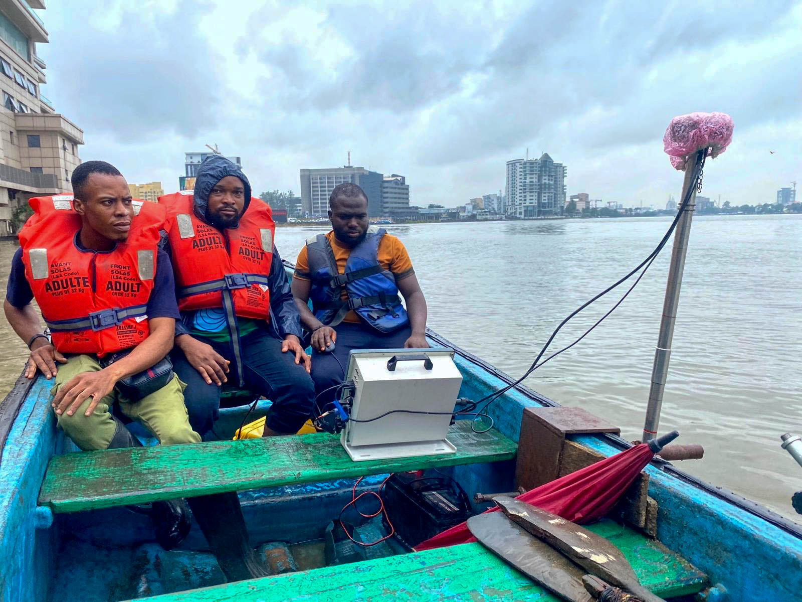
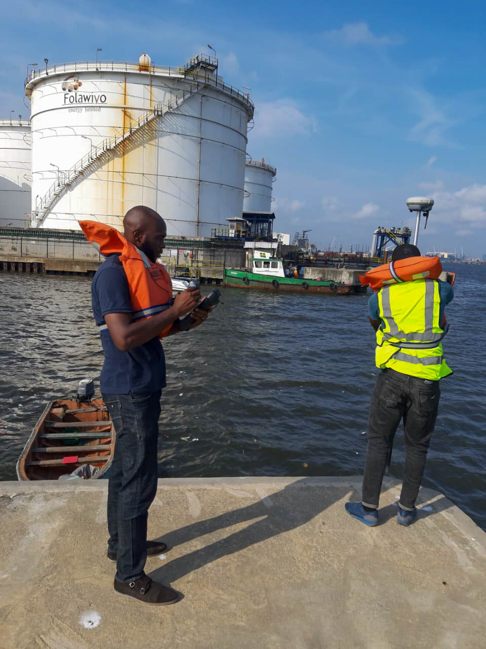
Bathymetric Survey at Ozumba Mbadiwe, Victoria Island - Prof Tower
Our team completed a comprehensive bathymetric survey at Victoria Island in 2023 for the Prof Tower project. Using advanced sonar technology, thousands of underwater data points were captured to accurately model the seabed and estimate the volume of sandfilling required for construction.
Bathymetric Survey - High-density underwater data
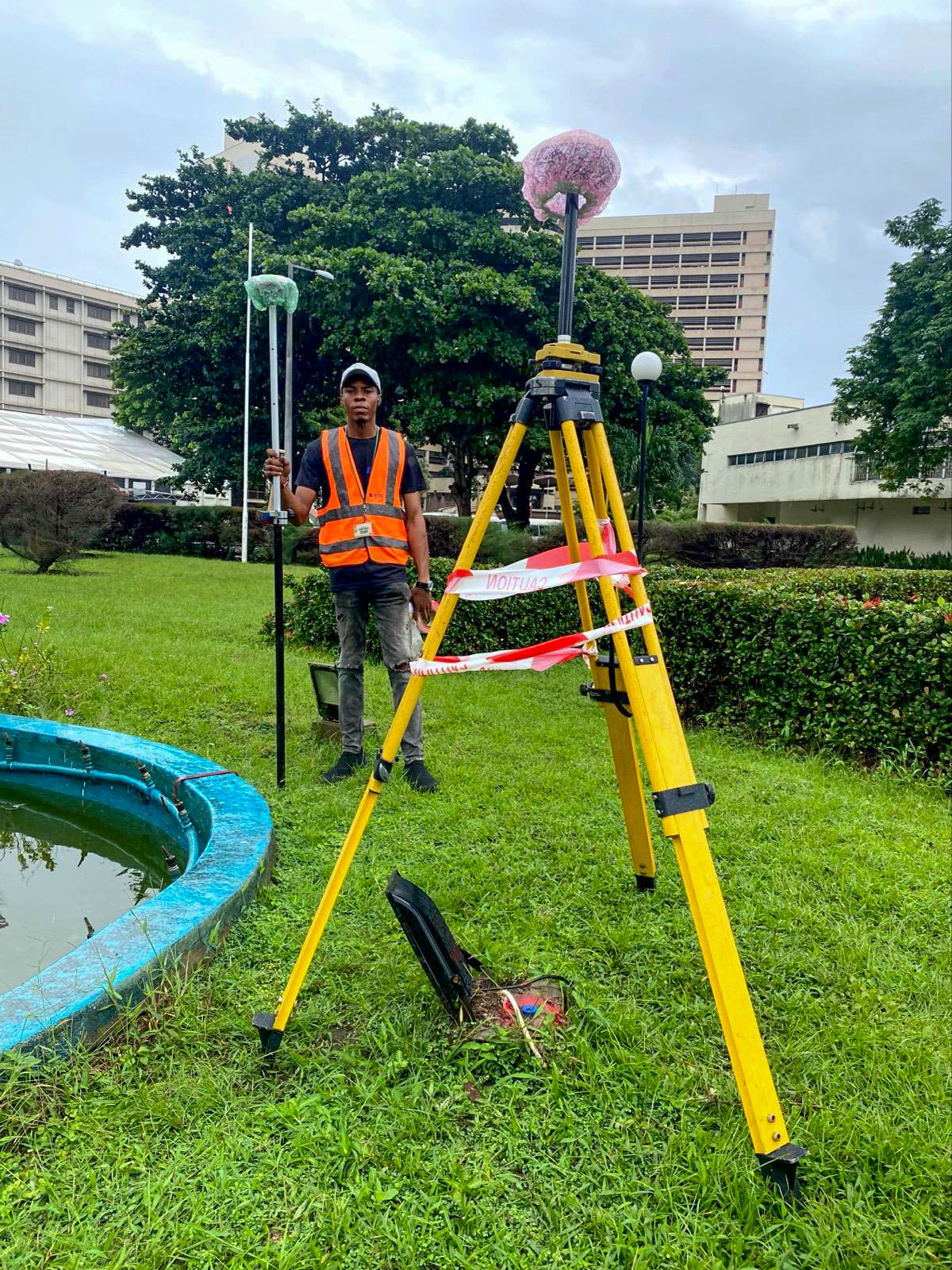
Topographic Survey at Federal Palace - Victoria Island
Our team completed a comprehensive topographic survey at Federal Palace, Victoria Island, utilizing GNSS, Total Station, and drone technology to capture detailed terrain and surface features across the site. High-density spatial data was collected to generate accurate topographic models, supporting site planning, design development, and informed construction decision-making.
Topographic Survey - High-density terrain data
As-built Survey and Topographic Detailing for GMT projects across Apapa, Victoria Island, and Satelite town axis.
Our team completed comprehensive as-built surveys for GMT across multiple sites, including Apapa and Satelite town axis. The scope involved detailed topographic surveying and spatial detailing to accurately document existing site conditions and constructed elements, supporting project documentation, planning, and future development decisions.
As-Built Survey - Detailed topographic documentation